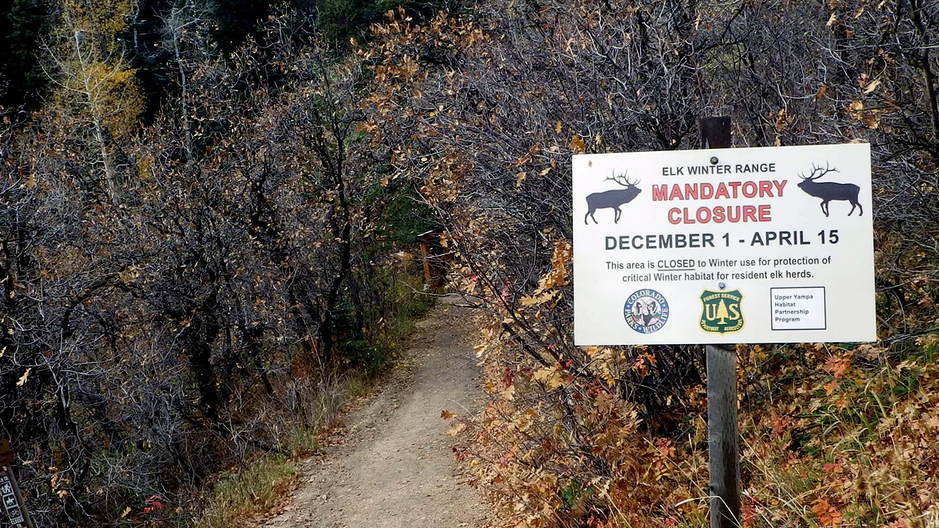
Seasonal closures are in place on about 12,000 acres in Routt National Forest. It’s the winter range areas for deer and elk. This includes trails such as Mad Creek, Red Dirt, Upper Spring Creek, and Hot Springs Trail. Those trails are marked with a Trail Closure sign. The full list is below of which trails have mandatory and which trails have voluntary closures in the area.
![]()
Press Release from the U.S. Forest Service Department of Agriculture; Dec. 28, 2023.
Seasonal closures in place for big-game habitat around Steamboat Springs
Temporary annual closures exist Dec. 1 to April 15
(STEAMBOAT SPRINGS, Colo.) December 28, 2023 – As visitors arrive in Routt County for the holidays, the U.S. Department of Agriculture Forest Service would like to remind those venturing out on the nearby Routt National Forest that seasonal closures for big-game winter range are enacted annually at multiple locations near Steamboat Springs.
Both mandatory and voluntary closures are in place from Dec. 1 to April 15 at trailheads and in areas where conflicts between wildlife and people have historically occurred.
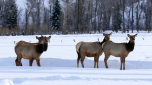
Approximately, 12,000 acres on the Routt National Forest have a seasonal closure of winter range for deer and elk in place. This includes trails such as Mad Creek, Red Dirt, Hot Springs, and Spring Creek.
The temporary closures for wintering wildlife are a result of a long-standing USDA Forest Service partnership with Colorado Parks and Wildlife. Areas critical for wildlife habitat have been identified through years of cooperation, while at the same time maintaining winter recreation access for the public.
“This is a great example of public commitment towards supporting balanced forest management,” said Hahns Peak/Bears Ears District Ranger Michael Woodbridge. “We would like to thank the local community and visitors to the area for decreasing human/wildlife conflict, which has helped keep more deer and elk on winter range. Public compliance with the closures in the last few years has been at a high level and we’re grateful for that.
Effective closures are only as good as public cooperation, so we ask the recreating public to continue respecting the winter closure areas. We encourage sharing information about these closures within the local community and with out-of-area visitors. Ultimately that communication will help us maintain the balance of wildlife and people that we strive for here in the Yampa Valley.”
A full list of closure areas is below. When respected, these closure areas provide pockets of habitat where vulnerable deer and elk find security and food during the harsh winter months without being disturbed by human activities.
The current closure areas include:
Mandatory
- Spring Creek Trail 1160
- Spring Creek Alternate Trail 1160.1A
- Mad Creek Road 128
- Mad Creek Trail 1100 (Swamp Park Trail)
- Red Dirt Trail 1171
- Hot Springs Trail 1169
- Foothills south of Steamboat Ski Area to Hwy 40
Voluntary
- Greenville Mine area (Roads 440 & 471)
- Coulton Creek area (Trail 1188 & Road 429)
- Lower Bear Trail 1206
- Sarvis Creek Trail 1105
- Silver Creek Trail 1106
- Areas adjacent to the Radium and Indian Run State Wildlife Areas (Roads 212 & 214)
- Area north of Toponas off Forest Road 285
Closure signage is posted at affected trailheads, and maps and brochures are available at area businesses and at Forest Service offices. Other area land managers, such as the City of Steamboat Springs and the Bureau of Land Management (BLM), also have seasonal area closures in place that recreational users should respect and be aware of.
Since some of the closure area borders Steamboat Ski Area, the Forest Service has worked closely with the resort to publicize the public access impacts. The ski area has included the big game winter range closure areas in their ski area trail maps and mandatory closure signs are posted along the ski area operating boundary between South Peak Lift and Broadway ski trail.
Recreationists are asked to use the following alternative winter recreation areas on the Forest: Buffalo Pass, Rabbit Ears Pass, Gore Pass, Lynx Pass, Bear River Corridor (entrance to the Flat Tops), and Dunckley Pass.
Other areas include the South Fork Trail (Trail 1100.5A) south of the Elk River with parking at the Hinman parking area (a non-motorized area) and Forest Road 430/Scott Run (Trail 1177). Another alternate area is located west of Routt County Road 129 at the Hahns Peak Lake Area on Forest Roads 486 and 488.
For more information about the closure areas or other areas recommended to recreate outside of winter range, please call either the Hahns Peak/Bears Ears Ranger District office at (970) 870-2299 or the Yampa Ranger District Office at (970) 638-4516. Additional information may be found on our website or on the Forest’s X/Twitter and Facebook accounts.
-USDA-
USDA is an equal opportunity provider, employer, and lender.