By Shannon Lukens.
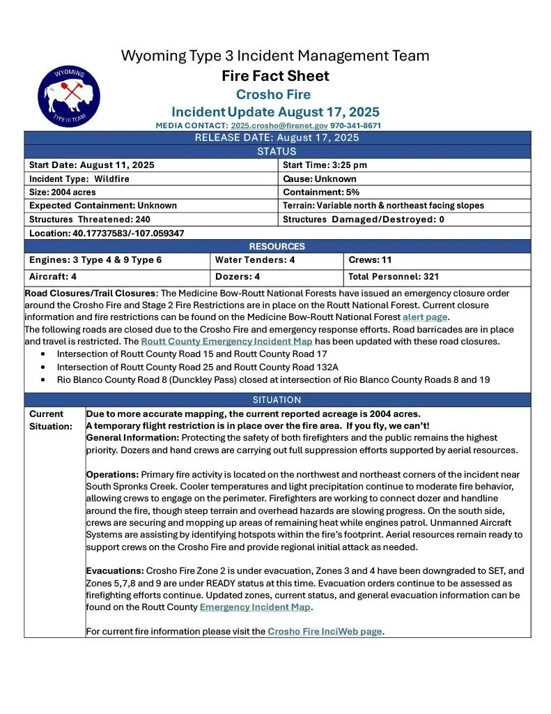
The Fire Fact Sheet (below) on the Crosho Fire, for Sunday, Aug. 17, has been released from the Rocky Mountain Wyoming Type 3 Incident Management Team. More accurate mapping shows the reported acreage that has burned is down to 2,004 acres. The Crosho Fire is at 5 percent containment as of Sunday morning. No structures have been damaged or destroyed, but 240 have been threatened. The fire has spread into Routt County and on private land, and it remains active.
The total number of personnel at the fire is at 321 on 11 crews, with four aircraft, four water tenders, four dozers, and three Type 4 engines and nine Type 6 engines.
A temporary flight restriction is in place over the fire area. “Dozers and hand crews are carrying out full suppression efforts supported by aerial resources.”
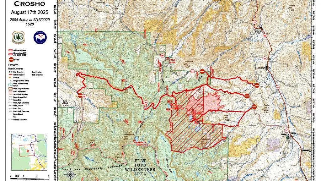
An area closure has been put in place for a portion of the Routt National Forest due to the Crosho Fire.
Primary fire activity is on the northwest and northeast corners of the incident near South Spronks Creek. “Cooler temperatures and light precipitation continue to moderate fire behavior, allowing crews to engage on the perimeter.”
However, here are the weather concerns according to the InciWeb report on the fire. “Expected cloud cover this evening. Erratic and gusty winds, low relative humidity values, and dry thunderstorms will continue to drive critical fire weather.”
Cloud cover is expected this evening with possible anticipated moisture but the report says:
- 24 hours: Return to elevated fire conditions. Potential for gusty, elevated winds could push fire in unanticipated directions, threatening firelines. Highest threat potential is along north and east flanks.
- 48 hours: Return to elevated fire conditions. Potential for gusty, elevated winds could push fire in unanticipated directions, threatening firelines. Highest threat potential is along north and east flanks.
- 72 hours: Return to elevated fire conditions. Potential for gusty, elevated winds could push fire in unanticipated directions, threatening firelines. Highest threat potential is along north and east flanks.
Unmanned aircraft are helping identify hotspots.
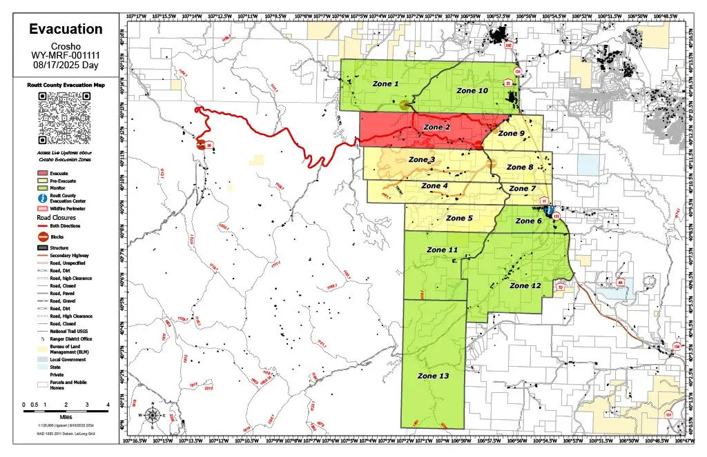
Crosho Fire Zone 2 is under evacuation. Zones 3 and 4 have been downgraded to SET, and Zones 5, 7, 8, and 9 are under READY status. (Map below.)
- Crosho Fire Update – Saturday, Aug. 16
- Medicine Bow-Routt National Forest alert page
- Routt County Emergency Incident Map
- Crosho Fire InciWeb page
- Crosho Fire on Watch Duty
- Aug. 12 Steamboat Radio coverage — Crosho Fire Update